
Maps

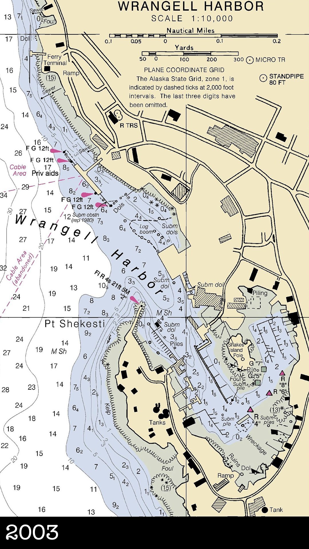
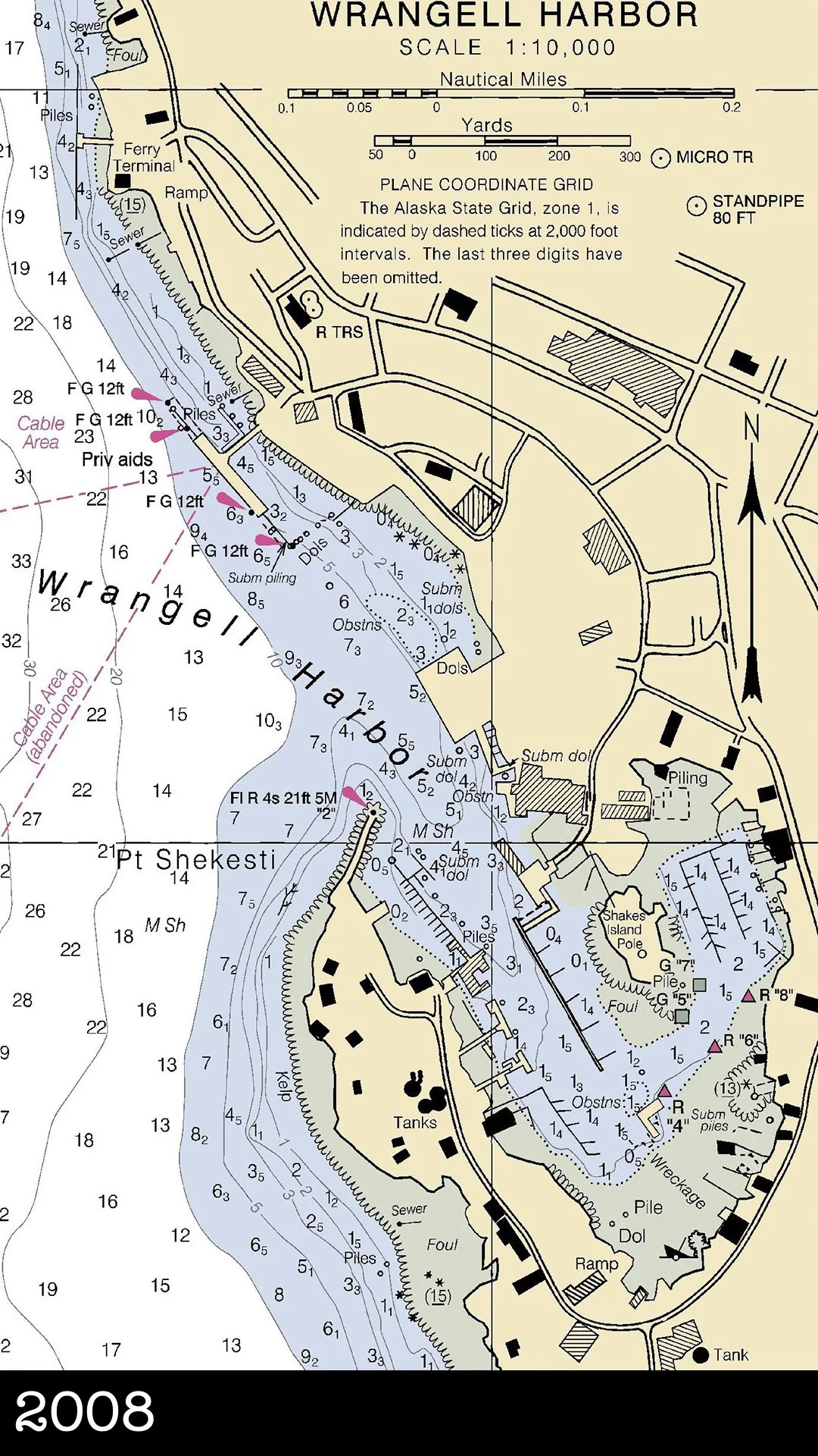
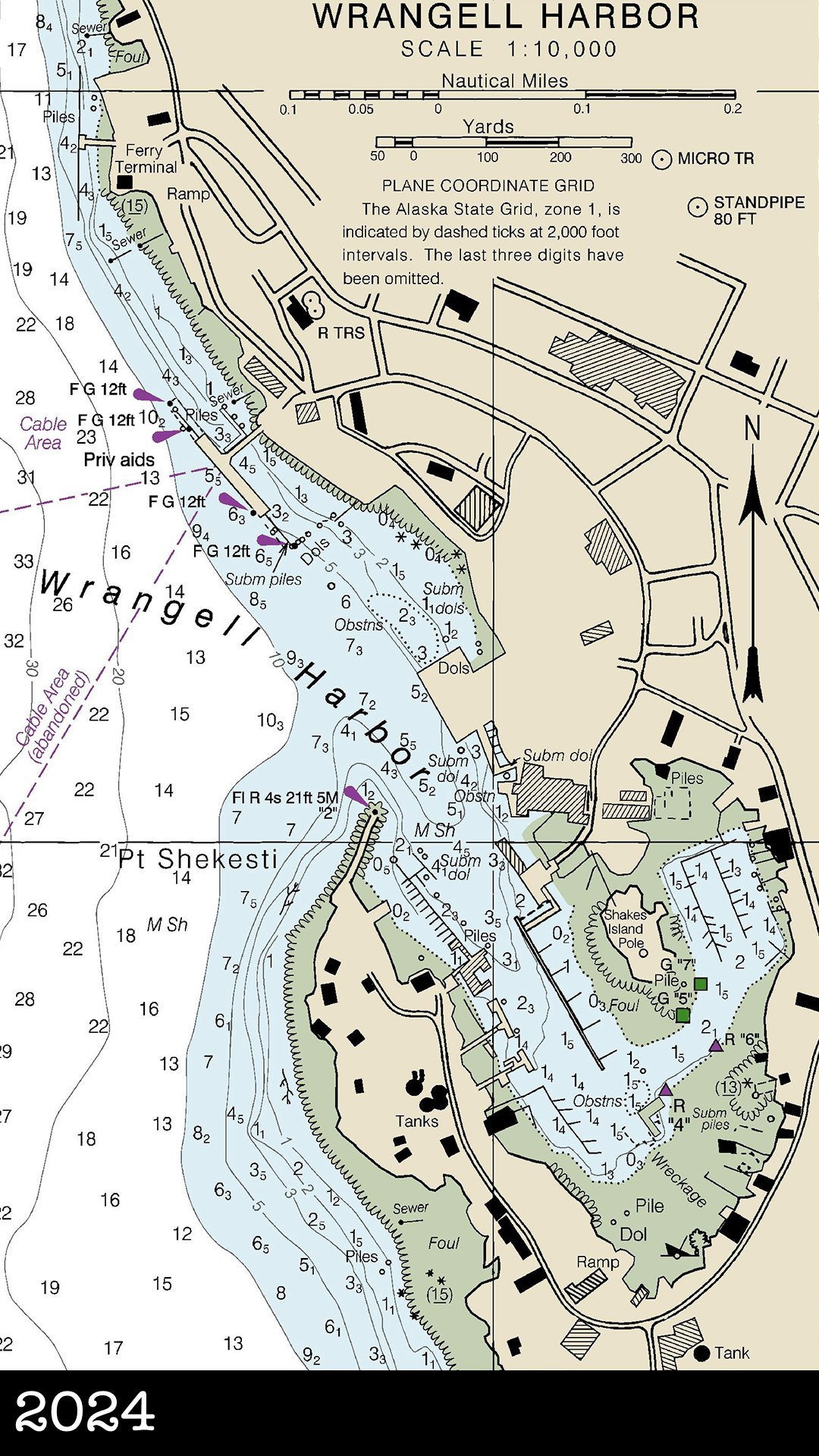
Wrangell Waterfront Timeline


Interactive Story Map
Find stories featured on Wrangell History Unlocked using this interactive Google map.

Etolin Harbor Colorized


Historic Places
FORT WRANGEL, late 1860s. The U.S. Army began clearing ground for Fort Wrangel in early 1868, just months after purchasing Russia’s interests in Alaska. The fort contained twelve buildings which survived for decades over three separate Army occupations.
WRANGELL INSTITUTE. This map is a composite based off photographs and available maps of the area. Many structures went up after the school opened in 1932. You can learn more on our Wrangell Institute research page.
ALASKA PACKERS ASSOCIATION CANNERY, date unknown. This map shows the Alaska Packers Association cannery at the north end of Wrangell Island, before Labouchere Bay was filled in to create the Wrangell Airport. (source: Alaska Packers Association Records, Series III: Property, Sub-Series 6: Survey Maps, Microfiche 448, Western Libraries, Western Washington University.)
Alaska Packers Association, Wrangell Cannery Salmon Streams. This map is an attempt to identify all the freshwater streams around southeast Alaska that provided salmon to Wrangell’s APA cannery. Learn more on our blog, Fish Trapped: Salmon Streams of Wrangell’s APA Cannery.